trekking-etc

Winter

BLINNENHORN

from Riale, Val Formazza

vetta

Here's a great trek in the heart of Val Formazza, in an extraordinary scenery. To complete the trip in one day, you have to be well trained. The route we followed was chosen for the greater safety of snow conditions, passes through the pasture Battelmatt and the glacier of Chamois and involves passing a steep gully about 45 degrees that is evaluated BSA (good ski-alpinist); otherwise you may choose to break it in two days, taking advantage of the many shelters in the area (Refuge Busto Arsizio, Refuge 3A).

We have chosen to go down through the valley of the Sabbione thus making a large ring: the downward path of the attached track can also be used for the ascent in case of safe snow conditions; also in this case there are several shelters (Refuge Mores, Refuge Claudio e Bruno) in order to break up the trip in two days.


Access

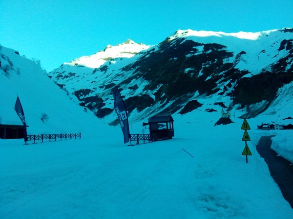
You reach Riale, following the signs for Val Formazza from Domodossola, and park before the town.

park


Ascent

You take the cross-country ski trail, and the valley on the left of the town, towards the dam of Morasco

pista fondo

verso la diga del Morasco

diga morasco

You go alongside the lake

dalla diga

and at the end you see on your left the valley of Sabbione, from where you will later descend.

vallone di discesa

You proceed in the direction of northwest past the Enel cable car station, and other buildings

Palina

towards the pasture of Battelmatt

itinerario dopo il lago

il lago alle spalle

Baita

Once in Battelmatt you take the valley to the left that leads to the Pian dei Camosci and Refuge Busto Arsizio

itinerario2

si risale

you go up in an inspiring environment

arbola e blinnenhorn

Already you can see the steep channel that you will have to climb to get to the Pass of Camosci and an old plant

itinerario3

passo dei camosci

verso il passo dei Camosci

From the saddle you should have a nice view of the Blinnenhorn, unless you find fog

passo

You lose 50m in altitude to reach the Griesgletscher, then you go towards the south ridge of the peak

finalmente la meta

thta you easily climb up to the top.

vetta

punto trigonometrico


Descent

You can follow the path forward.

Alternatively, you descend to the base of the final ridge and without reaching the Pass of Camosci, you head to the southern slopes of the Valley of Sabbione with its visible underlying lake, and from there to the dam of Morasco, as per attached track, thus accomplishing a beautiful ring.

fb, 2014-03-20

Copyright © 2010-2021 trekking-etc - All rights reserved
Developed by gb-ing, powered by etc-cms

terms of use - disclaimer - privacy and cookies

24874386