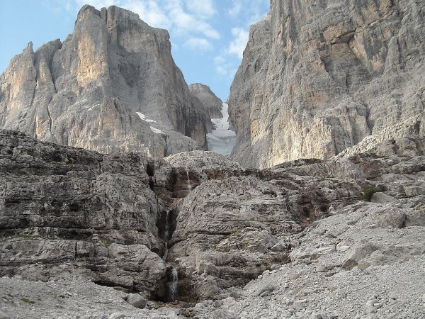
Canalone Neri
and small waterfalls, along the Sentiero Martinazzi
Photo 1 of 31
© gb for trekking-etc.it

Moon
on the ridge
Photo 2 of 31
© gb for trekking-etc.it

Sentiero Martinazzi
going round the Crozzon di Brenta
Photo 3 of 31
© gb for trekking-etc.it

Going up
along the Vedretta dei Camosci
Photo 4 of 31
© gb for trekking-etc.it

Vedretta dei Camosci
towards Bocca d'Ambiez
Photo 5 of 31
© gb for trekking-etc.it

Climbing up
the vedretta
Photo 6 of 31
© gb for trekking-etc.it

Crossing
towards the ferrata
Photo 7 of 31
© gb for trekking-etc.it

View
towards the Carè Alto
Photo 8 of 31
© gb for trekking-etc.it

Ferrata
towards the Bocca d'Ambiez
Photo 9 of 31
© gb for trekking-etc.it

Bocca d'Ambiez
Photo 10 of 31
© gb for trekking-etc.it

Via Migotti
view towards the summit
Photo 11 of 31
© gb for trekking-etc.it

Via Migotti
climbing
Photo 12 of 31
© gb for trekking-etc.it

Via Migotti
climbing along the middle part
Photo 13 of 31
© gb for trekking-etc.it

Panorama
from Via Migotti
Photo 14 of 31
© gb for trekking-etc.it

Cima Tosa
the snow dome on the summit
Photo 15 of 31
© gb for trekking-etc.it

Towards the summit
Photo 16 of 31
© gb for trekking-etc.it

Panorama
towards Cima d'Ambiez
Photo 17 of 31
© gb for trekking-etc.it

Zoom
towards the Carè Alto
Photo 18 of 31
© gb for trekking-etc.it

Zoom
towards the Presanella
Photo 19 of 31
© gb for trekking-etc.it

Descent
where is the point for the double rope?
Photo 20 of 31
© gb for trekking-etc.it

There, let's go
Photo 21 of 31
© gb for trekking-etc.it

Preparation
for a double rope
Photo 22 of 31
© gb for trekking-etc.it

Double rope
Photo 23 of 31
© gb for trekking-etc.it

View
with the Campanile Basso
Photo 24 of 31
© gb for trekking-etc.it

Zoom
on the Campanile Basso
Photo 25 of 31
© gb for trekking-etc.it

Cima Tosa
from path 358
Photo 26 of 31
© gb for trekking-etc.it

Rifugio Pedrotti
Photo 27 of 31
© gb for trekking-etc.it

From Rifugio Pedrotti
towards Bocca di Brenta
Photo 28 of 31
© gb for trekking-etc.it

Val Brenta Alta
Photo 29 of 31
© gb for trekking-etc.it

Rifugio Brentei
Photo 30 of 31
© gb for trekking-etc.it

Small church
near Rifugio Brentei
Photo 31 of 31
© gb for trekking-etc.it

