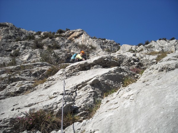
Cima alle Coste, from località Oltra
This climbing route, opened in March 2008 by Heinz Grill, Siegrid Königseder and others, is pleasant and takes place on excellent rock, despite the limited difficulties. It can be climbed throughout the year, preferring the morning during the cold season, given the exposure to the east.
The route is secured with bolts and lanyards, the stops are well equipped. However, you may find useful an assortment of lanyards (the original ones suffer the ravages of time), and some friend.
There is a more difficult exit variant (VI-), not described here.
Along the SS45bis, just north of Dro, you turn right and take the road signposted Oltra, then right again, with indications to the sports field. You quickly reach the parking lot adjacent to the sports field.
You take the path towards the west, which soon forks. You go in a northerly direction, following the wide path, up to a junction ander a scree, where you turn left:
Go up the trail (not the path that points more decisively in the woods), to skirt the base of the wall. Shortly after the start of the route Mercurio Serpeggiante, you find the attack of the Bellezza della Venere (route name at the base).
L1, L2: You climb up the easy rocks:
The first length does not exceed grade III, the second has some stretch of IV-.
L3: You climb up on plaques, substantially straight, for a stretch of grade up to IV, then easier. The stop lies on a boulder a bit on the right.
L4: You go up again, keeping to the left of a gully, and then return into it when it turns into a dihedral:
After going up a few meters, with a passage to the right, you reach the notch where you find the stop. III, IV+.
L5: You climb the right side of the dihedral, on vertical rock, although rich of holds. You reach a ledge, which you cross to the right for a good 15 m, and then go up straight, aiming for the dihedral below the characteristic pyramid:
After a passage on a plaque, you climb up the dihedral, then traverse to the left, then oblique right, to find the stop on top of the spur. IV+, IV.
L6, L7: You go up on easy rocks, cross on the left a gravel channel, pointing to a very visible dihedral with crack, that you climb up:
You climb the easy rocks that follow, take a small ledge on the right, and climb left until the stop:
II, IV+, IV, II.
L8: You cross to the left under the wall, pass the ledge break thanks to a tree, and then up left at an angle and traversing along the gray and yellow plaque:
You stop on the tree. II, III, IV+.
L9: You climb up, overcoming a wall above the stop, and then a few steps
to reach the beautiful inclined exit plaque:
The crack that runs through it allows you to easily overcome it. Finally, you pass a small wall, and find the final stop on a rock shortly after. IV+, III.
You follow the trail to the south, which first rises for a few tens of meters:
then goes down and traverses, still southwards:
This way you reach the Cavra del Vincenzo (an ancient ropeway):
From there, you go downhill on the trail named Sentiero delle Cavre, to descend into the valley, at a capital. You turn left and shortly after to the right, thus returning to the parking lot.
■ gb, 2014-03-07