SIXTH STAGE
From Offagna to Sirolo

Final stage of TraversaMarche, with arrival on the coast.
The path starts from Offagna, through hilly landscapes, descending towards Ponte dell'Aspio, surrounded by greenery.
You quickly cross the valley floor to the Aspio Terme area, where industry and commerce, and related traffic, are bustling, then you find a rural landscape again, and you go up to the beautiful village of Camerano, thus entering the Conero Regional Park.
A down- and up-hill path leads to Massignano, from where you descend the slopes of Monte Conero to Sirolo, the arrival point.
Towards San Biagio
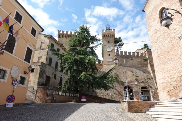
From Piazza del Comune in Offagna,

you go down to Via dell'Arengo, following it entirely; after 260 m from the start you reach a large roundabout, which you go around to the right, to take the third exit, Via De Gasperi:


About 400 m further on, you continue straight on Via Massa, following it for 360 m,

then at a fork, you keep left, continuing along Via San Bernardino, for about 1500 m:

A left turn follows,

and 190 m further on you join the SP 28 to the right.
You continue on the SP 28 for about 2.5 km, following straights and curves, until you reach the intersection with Via Ancona, on the outskirts of the town of San Biagio.
Crossing the Valley of Aspio
You continue straight along Via Colle San Biagio for 900 m, then turn left onto a dirt road, just after an electricity line pylon.
You follow it for 860 m, in the middle of the countryside, up to a crossroads where you take Via Colle San Biagio, on the right, and follow it for 460 m, up to the motorway underpass.
About 150 m further on, you come across Via Aspio Terme, SS 16; you take it to the left, and 30 m further on cross you it to the right, with due caution, to take Via Stazione.
Another 150 m further on, immediately after the railway underpass, you turn left into Via Farfisa, following it for just over 400 m, until you reach a roundabout, without a pavement, which you go around to the right,

continuing straight along the same street, for 180 m.
You then reach another roundabout, where you turn right, along the Direttissima del Conero, which has no pavement and is very busy:

Follow it carefully for 380 m, towards the south-east,

and then turn left onto Via Fontanelle, a quiet country road:

Towards Camerano
You find yourself immersed in greenery again, after the necessary urban interlude:


From the beginning of the road, you proceed for approximately 1.6 km,

overcoming a 160 m difference in altitude with varying slope, until you reach the outskirts of Camerano:

You come across Via Provinciale Cameranense, which you follow to the right for about 30 m, then take Via Marinelli on the left:


Via Marinelli continues without interruption into Via Garibaldi,

and 520 m after leaving the provincial road, you arrive to the center of Camerano, in Piazza Roma:

Towards Massignano
You leave Camerano proceeding along Via Maratti, and a short stretch of Via Loretana, for a total of 220 m;

then take a staircase on the right:

About 60 m further on, at the intersection of Via Loretana and Via S. Germano, you take the latter, slightly to the left:

You walk north-east for 320 m, then deviate slightly to the right taking Via Massignano:

You go down the road for 860 m:


Then you turn left onto Via Bagnolo, a country road, following it for 500 m;

in the meantime there is a the curve to the right,

with signs for path 316,

then the curve to the left,

and then turn right (again sign for path 316),

You proceed through the countryside for less than 900 m,

while Camerano is now more than 1 km behind:

You continue along the beautiful path, now uphill,

passing a house,

and proceeding at times through the vegetation,

then on a narrow track between the fields:

You come across Via Massignano again, and take it on the left:

You follow the road for 680 m, uphill,

with magnificent views of the landscape:

until you reach the center of Massignano, a typical hill village:

Towards Sirolo
You take your time for a short chat with some friendly members of the local Therapeutic Community,

a look towards the sea,

then you continue for another 300 m, until you find, shortly after the town, the SP 1, which has no longer been very busy since the Strada Direttissima del Conero was built; you take it to the right:


You follow it downhill for about 1.2 km, then turn right near a left bend:

You continue along a very quiet road, surrounded by greenery:

At a fork in the road, 380 m further on, you continue straight:


After 150 m you pass the little church of the Madonnina,

continue along Via San Lorenzo, for less than 500 m,

reaching the first houses of Sirolo:

You continue along Via le Vigne, walking for 850 m,

even when it bends to the left,


and continue, still straight, along Via Raffaello Sanzio:

You then reach a roundabout, where you turn right onto Via Giulietti:

You follow it for less than 500 m,

first reaching the Church of San Nicolò di Bari,

and shortly after the central Piazzale Marino, with a panoramic view of the Conero:

■ gb, 2019-06-01


